Phan Thiết (Thành Phố Phan Thiết)
Phan Thiết is the capital of Bình Thuận Province on the southeast coast in Vietnam. While most of the inhabitants live in the city center, others reside in the four urban coastal wards, extending from Suối Nước beach in the northeast towards cape Kê Gà in the southwest.
Traditionally, fishing and the manufacturing of fish sauce served as the main source of Phan Thiết's local economy. The rise of tourism as the region's primary employer can be attributed to its beaches, and thus its growth is rapidly overshadowing its prevalent fishing industry.
There are several theories relating to the origin of the name Phan Thiết, most of which argue is not an authentic Vietnamese name:
* Before the Vietnamese conquest of the area in the 17th century, the Cham people called the land "Hamu Lithit" – with "Hamu", meaning 'hamlet in the field', and "Lithit", defined as 'near the sea'. Coinciding with the arrival of Vietnamese settlers, a new name in Vietnamese was gradually developed. Since the Vietnamese had already altered the Cham city of Panduranga into Phan Rang and another settlement into Phan Rí, they attached the prefix "Phan" into the shortening of "Lithit" to make the name Phan Thiết.
* Vietnamese people have been transliterating the Cham names into more 'traditional' Vietnamese sounding names: Panduranga or Mang-lang into Phan Rang, Mang-lý into Phan Rí and Hamu Lithit or Mang-thit into Phan Thiết respectively. The three places are referred to as "Tam Phan" (Triple Phan).
* The name of the Cham Prince who served as the area's military governor in the 15th century was Po Thit (brother of the princess Po Sah Inư and son of King Par Ra Chăm Chanh or Trà Chanh). The fortification was thus called Camp Po Thit. The Vietnamese subsequently pronounced the camp name as "Phan Thiết."
Map - Phan Thiết (Thành Phố Phan Thiết)
Map
Country - Vietnam
 |
 |
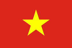
| Flag of Vietnam | |
Vietnam was inhabited by the Paleolithic age, with states established in the first millennium BC on the Red River Delta in modern-day northern Vietnam. The Han dynasty annexed Northern and Central Vietnam under Chinese rule from 111 BC, until the first dynasty emerged in 939. Successive monarchical dynasties absorbed Chinese influences through Confucianism and Buddhism, and expanded southward to the Mekong Delta, conquering Champa. The Nguyễn—the last imperial dynasty—surrendered to France in 1883. Following the August Revolution, the nationalist Viet Minh under the leadership of communist revolutionary Ho Chi Minh proclaimed independence from France in 1945.
Currency / Language
| ISO | Currency | Symbol | Significant figures |
|---|---|---|---|
| VND | Vietnamese đồng | ₫ | 0 |
| ISO | Language |
|---|---|
| KM | Central Khmer language |
| ZH | Chinese language |
| EN | English language |
| FR | French language |
| VI | Vietnamese language |


